资源简介
ArcGIS server 的最优路径分析

代码片段和文件信息
// Copyright 2007 ESRI
//
// All rights reserved under the copyright laws of the United States
// and applicable international laws treaties and conventions.
//
// You may freely redistribute and use this sample code with or
// without modification provided you include the original copyright
// notice and use restrictions.
//
// See use restrictions at /arcgis/developerkit/userestrictions.
//

using System;
using System.Collections;
using System.ComponentModel;
using System.Data;
using System.Drawing;
using System.xml;
using System.Web;
using System.Web.SessionState;
using System.Web.UI;
using System.Web.UI.WebControls;
using System.Web.UI.HtmlControls;
using ESRI.ArcGIS.ADF.Web.DataSources.ArcGISServer;
using ESRI.ArcGIS.ADF.Web.Geocode;
using ESRI.ArcGIS.ADF.Web.DataSources;

namespace RouteFinder
{
	public partial class _Default : System.Web.UI.Page
	{
		protected void Page_Init(object sender EventArgs e)
		{
			if (Session.IsNewSession)
			{
				Session.Add(“ModifiedNAContextApplied“ false);
			}
		}

		///
		/// Creates an array of xy coordinates for the passed locationString.
		///
		///
		private void GeocodeAddress(IGeocodeFunctionality igf string address string zip out double x out double y)
		{
			x = Double.NaN;
			y = Double.NaN;

			System.Collections.Generic.List avc = new System.Collections.Generic.List();
			AddressValue av1 = new AddressValue(“STREET“ address);
			AddressValue av2 = new AddressValue(“ZONE“ zip);
			avc.Add(av1);
			avc.Add(av2);

			ESRI.ArcGIS.ADF.Web.Geometry.Point geocodedPoint = igf.GeocodeAddress(avc);
			x = geocodedPoint.X;
			y = geocodedPoint.Y;

			return;
		}

		///
		/// Updates the form elements with values saved in session
		///

		private void GetPreviousParameters()
		{
			if (Session[“FromAddress“] == null)
				return;

			FromStreet.Value = Session[“FromAddress“].ToString();
			FromZip.Value = Session[“FromZip“].ToString();
			ToStreet.Value = Session[“ToAddress“].ToString();
			ToZip.Value = Session[“ToZip“].ToString();
		}

		protected void btnGetDirections_Click(object sender System.EventArgs e)
		{
			if (!GeocodeResourceManager1.Initialized)
				GeocodeResourceManager1.Initialize();

			IGISResource gisResource = GeocodeResourceManager1.GetResource(0);
			if (gisResource == null)
				throw new Exception(“Error getting Geocode resource.  Make sure you have set up the identity in web.config“);

			bool supported = gisResource.SupportsFunctionality(typeof(ESRI.ArcGIS.ADF.Web.DataSources.IGeocodeFunctionality));

			if (supported)
			{
				IGeocodeFunctionality igf = (IGeocodeFunctionality)gisResource.CreateFunctionality(typeof(IGeocodeFunctionality) null);

				double fromX fromY toX toY;

				Session[“FromAddress“] = FromStreet.Value.ToString();
				Session[“FromZip“] = FromZip.Value.ToStrin
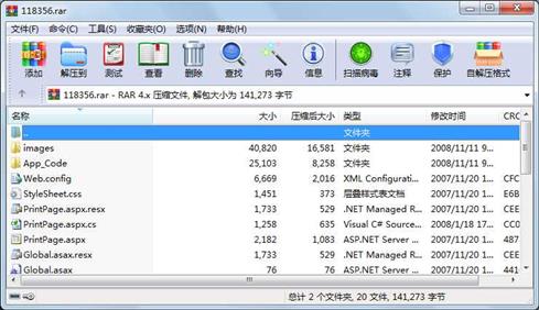
属性 大小 日期 时间 名称
----------- --------- ---------- ----- ----
文件 1733 2007-11-20 10:55 Global.asax.resx
文件 2182 2007-11-20 10:55 PrintPage.aspx
文件 1258 2008-01-18 17:57 PrintPage.aspx.cs
文件 1733 2007-11-20 10:55 PrintPage.aspx.resx
文件 1451 2007-11-20 10:55 st
文件 6669 2007-11-20 10:55 Web.config
文件 3197 2008-01-18 17:57 App_Code\AssemblyInfo.cs
文件 3866 2008-01-18 17:57 App_Code\CustomTools.cs
文件 2410 2008-01-18 17:57 App_Code\Global.asax.cs
文件 1010 2008-01-18 17:57 App_Code\Iba
文件 2012 2008-01-18 17:57 App_Code\NetworkAnalystRouteResult.cs
文件 12608 2008-01-18 17:57 App_Code\NetworkAnalystUtility.cs
文件 962 2007-11-20 10:55 images\fullroute.gif
文件 1024 2007-11-20 10:55 images\fullrouteD.gif
文件 1016 2007-11-20 10:55 images\fullrouteU.gif
文件 950 2007-11-20 10:55 images\newroute.gif
文件 914 2007-11-20 10:55 images\pan.gif
文件 962 2007-11-20 10:55 images\panD.gif
文件 965 2007-11-20 10:55 images\panU.gif
文件 926 2007-11-20 10:55 images\print.gif
文件 942 2007-11-20 10:55 images\reverseroute.gif
文件 26112 2007-11-20 10:55 images\Thumbs.db
文件 333 2007-11-20 10:55 images\working.gif
文件 924 2007-11-20 10:55 images\zoomin.GIF
文件 972 2007-11-20 10:55 images\zoominD.gif
文件 968 2007-11-20 10:55 images\zoominU.gif
文件 920 2007-11-20 10:55 images\zoomout.GIF
文件 965 2007-11-20 10:55 images\zoomoutD.gif
文件 965 2007-11-20 10:55 images\zoomoutU.gif
文件 1520 2008-11-11 10:17 ArcGIS_Routing_CSharp.sln
............此处省略18个文件信息
- 上一篇:编译原理实验报告 词法分析器实验报告
- 下一篇:UC3842应用中的电压反馈电路探讨
相关资源
- ArcGIS Engine最优路径分析
- arcgis engine实现叠加分析
- arcgis 10.1 中文环境安装包
- Arcgis 扩展模块
- shp转cad小工具
- 插件式GIS应用框架的设计与实现&mda
- 中国工具——gis插件
- ArcGiS手把手教程三——配准和矢
- arcgis_workstation地址
- ArcGIS_ArcInfo_9.3_Workstation_DVD_BT
- 全国耕地质量大数据平台
- arcpy语法教程入门以及ArcGIS的脚本构建
- ArcGis 编辑过程自动保存插件
- ArcGIS10.3 AfCore.dll重要破解文件
- 广东电子地图.rar
- 基于ArcGIS Engine的三维校园路灯管理系
- 全国省级市级县级矢量地图数据
- 完整的中国矢量地图gis数据
- 中国省市县ArcGIS地图数据(县边界线
- 中国ArcGIS数据
- ArcGIS10服务器未运行的最佳解决办法
- ArcGIS可打开并使用的世界地图
- ArcGIS空间分析基本操作
- 长江经济带shp.zip
- arcgis批量出图
- ArcGIS超级工具1.7.exe
- ArcGIS-温度划分梯度.pdf
- ArcGIS全套图标4000+
- 汤国安arcgis教程
- 山东省矢量图
 川公网安备 51152502000135号
评论
共有 条评论