资源简介
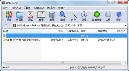
《Web GIS开发——ArcGIS Server与.NET》一书的全部源码
刘光,唐大仕著

代码片段和文件信息
using System;
using System.Data;
using System.Configuration;
using System.Web;
using System.Web.Security;
using System.Web.UI;
using System.Web.UI.WebControls;
using System.Web.UI.WebControls.WebParts;
using System.Web.UI.HtmlControls;
using System.Collections.Specialized;

using ESRI.ArcGIS.ADF.Web.DataSources;

public partial class _Default : System.Web.UI.Page ICallbackEventHandler
{
    public string getResourceContentCallBack;
    public string showFieldInfoCallBack;
    public string attributeQueryCallBack;

    protected void Page_Load(object sender EventArgs e)
    {
        if (!Page.IsPostBack)
        {
            //layerList.Attributes[“onchange“] = “ShowFieldInfo()“;
        }
        getResourceContentCallBack = Page.Clientscript.GetCallbackEventReference(this
            “message“ “processCallbackResult“ “context“ “postBackError“ true);
        showFieldInfoCallBack = Page.Clientscript.GetCallbackEventReference(this
            “message“ “processCallbackResult“ “context“ “postBackError“ true);
        attributeQueryCallBack = Page.Clientscript.GetCallbackEventReference(this
            “message“ “processCallbackResult“ “context“ “postBackError“ true);
    }

    protected void Page_PreRender(object sender EventArgs e)
    {
        //if (!IsPostBack)
        //    GetResourceContent();
    }

    private void GetResourceContent()
    {
        IMapFunctionality mf = (IMapFunctionality)Map1.GetFunctionality(“NorthAmericaMap“);
        IGISResource gisresource = mf.Resource;
        bool supported = gisresource.SupportsFunctionality(typeof(IQueryFunctionality));

        if (!supported)
            return;

        IQueryFunctionality qfunc = (IQueryFunctionality)gisresource.CreateFunctionality(typeof(IQueryFunctionality) null);

        string[] lids;
        string[] lnames;
        qfunc.GetQueryablelayers(null out lids out lnames);
        for (int i = 0; i < lnames.Length; i++)
        {
            ListItem item = new ListItem(lnames[i] lids[i]);
            //layerList.Items.Add(item);
        }
    }

    #region ICallbackEventHandler Members
    private string callbackArg;

    string ICallbackEventHandler.GetCallbackResult()
    {
        // 判断是否有相应的缓存信息
        string cachedResponse = Cache[callbackArg] as string;
        if (cachedResponse != null)
        {
            return cachedResponse;
        }

        // 将传入参数依据&分割符分到querystring变量中
        Array keyValuePairs = callbackArg.Split(“&“.ToCharArray());
        NameValueCollection queryString = new NameValueCollection();
        string[] keyValue;
        string response = ““;
        if (keyValuePairs.Length > 0)
        {
            for (int i = 0; i < keyValuePairs.Length; i++)
            {
                keyValue = keyValuePairs.GetValue(i).ToString().Split(“=“.ToCharArray());
                queryString.Add(keyValue[0] keyValue[1]);
            }
属性 大小 日期 时间 名称
----------- --------- ---------- ----- ----
文件 8109 2008-10-05 17:19 Code of Web GIS Development\AttributeQuery\App_Code\GisFunctionality.cs
文件 40960 2006-01-15 09:49 Code of Web GIS Development\AttributeQuery\Bin\AspAlliance.CacheManager.dll
文件 28672 2008-10-05 16:33 Code of Web GIS Development\AttributeQuery\Bin\xm
文件 60928 2008-10-05 16:33 Code of Web GIS Development\AttributeQuery\Bin\xm
文件 8578 2007-12-26 10:23 Code of Web GIS Development\AttributeQuery\css\st
文件 7524 2008-10-20 20:37 Code of Web GIS Development\AttributeQuery\Default.aspx
文件 4601 2008-10-01 00:07 Code of Web GIS Development\AttributeQuery\Default.aspx.cs
文件 12705 2007-10-16 22:54 Code of Web GIS Development\AttributeQuery\Images\Toolbar\clearhighlight_1.jpg
文件 12650 2007-10-16 22:54 Code of Web GIS Development\AttributeQuery\Images\Toolbar\clearhighlight_2.jpg
文件 13331 2007-10-16 22:53 Code of Web GIS Development\AttributeQuery\Images\Toolbar\clearhighlight_3.jpg
文件 12726 2007-10-17 16:27 Code of Web GIS Development\AttributeQuery\Images\Toolbar\fullextent_1.jpg
文件 12703 2007-10-17 16:27 Code of Web GIS Development\AttributeQuery\Images\Toolbar\fullextent_2.jpg
文件 13343 2007-10-17 16:27 Code of Web GIS Development\AttributeQuery\Images\Toolbar\fullextent_3.jpg
文件 13312 2007-10-16 22:59 Code of Web GIS Development\AttributeQuery\Images\Toolbar\identify_1.jpg
文件 13265 2007-10-16 23:00 Code of Web GIS Development\AttributeQuery\Images\Toolbar\identify_2.jpg
文件 13954 2007-10-16 23:00 Code of Web GIS Development\AttributeQuery\Images\Toolbar\identify_3.jpg
文件 12974 2007-10-16 23:02 Code of Web GIS Development\AttributeQuery\Images\Toolbar\pan_1.jpg
文件 12949 2007-10-16 23:02 Code of Web GIS Development\AttributeQuery\Images\Toolbar\pan_2.jpg
文件 13516 2007-10-16 23:02 Code of Web GIS Development\AttributeQuery\Images\Toolbar\pan_3.jpg
文件 12709 2007-10-16 22:57 Code of Web GIS Development\AttributeQuery\Images\Toolbar\select_circle_1.jpg
文件 12670 2007-10-16 22:57 Code of Web GIS Development\AttributeQuery\Images\Toolbar\select_circle_2.jpg
文件 13233 2007-10-16 22:57 Code of Web GIS Development\AttributeQuery\Images\Toolbar\select_circle_3.jpg
文件 2638 2008-05-22 14:36 Code of Web GIS Development\AttributeQuery\Images\Toolbar\select_line_1.jpg
文件 2617 2008-05-22 14:36 Code of Web GIS Development\AttributeQuery\Images\Toolbar\select_line_2.jpg
文件 2616 2008-05-22 14:37 Code of Web GIS Development\AttributeQuery\Images\Toolbar\select_line_3.jpg
文件 13722 2007-10-16 22:56 Code of Web GIS Development\AttributeQuery\Images\Toolbar\select_polygon_1.jpg
文件 13684 2007-10-16 22:56 Code of Web GIS Development\AttributeQuery\Images\Toolbar\select_polygon_2.jpg
文件 14355 2007-10-16 22:56 Code of Web GIS Development\AttributeQuery\Images\Toolbar\select_polygon_3.jpg
文件 12750 2007-10-16 22:59 Code of Web GIS Development\AttributeQuery\Images\Toolbar\select_rect_1.jpg
文件 12694 2007-10-16 22:58 Code of Web GIS Development\AttributeQuery\Images\Toolbar\select_rect_2.jpg
............此处省略972个文件信息
相关资源
- USB.Over.Network.Server 注册机
- Servlet API中文文档
- dotnet 写字板 实验 源代码 不好请要不
- .net面试简历内容非常细致
- ArcGIS Engine最优路径分析
- .net网站服装销售系统(MVC)
-
分别适用于.NET fr
amework 2.0和4.0的E - arcgis engine实现叠加分析
-
安装 .net fr
amework 4.0失败原因是KB9 - arcgis 10.1 中文环境安装包
- Arcgis 扩展模块
- vs2005骑士巡游问题-分治法C
- 企业销售管理信息系统(全套)
- 选择题自动考试系统
- EXCEL文件转换成固定的格式的文本格式
- .net计件工资管理程序 啊
- powerdatagrid控件 源码
- shp转cad小工具
- SunnyUI.Net
- .NET WinForm 和 WPF 的UI界面库,收集整合
- web开发舔狗日记 框架bootstrap
- Oxford Industries 采用 Microsoft.NET 平台实
- ssk皮肤
- dotnetfx_cleanup_tool .NET删除工具
- 《WCF服务编程(第三版)》.pdf
- 初学Visual Basic 2010代码
- 网上购物商城系统完整版
- Butterfly.net通过按需计算推动下一代游
- 插件式GIS应用框架的设计与实现&mda
- 中国工具——gis插件
 川公网安备 51152502000135号
评论
共有 条评论